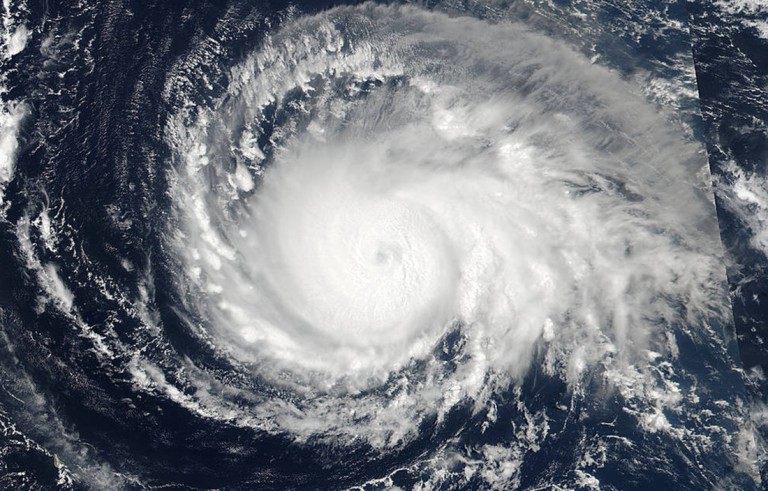
JUDY WOODRUFF: In the day's other major story, Hurricane Irma is now the most powerful storm ever recorded in the open Atlantic Ocean. It has winds of 185 miles an hour, and it's closing in on the Northeast Caribbean. That has one forecaster warning that the Leeward Islands are going to get destroyed.
Ed Rappaport is the acting director of the National Hurricane Center. And he joins me from Miami.
Ed Rappaport, the strongest storm ever in the Atlantic, what is known about Irma right now?
ED RAPPAPORT, Acting Director, National Hurricane Center: Well, the winds are at what we would put as a Category 5 level. That's as high as it goes.
And the concern is that we don't expect there to be a lot of change in intensity over the next several days as the hurricane moves to the west. And here's the forecast from the National Hurricane Center. And we have got the center forecast to move across the northeast wind, eastward, Lesser Antilles, and very near the north coast of Puerto Rico, Hispaniola and then Cuba as a Category 4 or perhaps still Category 5 hurricane.

JUDY WOODRUFF: Why are you saying you don't expect much change in the storm?
ED RAPPAPORT: Well, for one, this is as strong as we have ever seen in that area, so we don't — the conditions have come together in such a way as to produce this.
But it's not clear how we could see something even stronger than that. We do see fluctuations at times with storms that are this intense. It may go up a little. It may come down. But, regardless, when it approaches the islands and potentially makes landfall on some of the islands farther to the West, it will be Category 4, Category 5, maybe Category 3.
But the differences are really going to be inconsequential. It's a potentially devastating hurricane, and with severe impacts from wind, storm surge, and possibly also rainfall.
JUDY WOODRUFF: And, Ed, we know, right now, it's in the Caribbean, in the islands, but what about in the United States. What are concerns? What should they be now?
ED RAPPAPORT: Yes, the next 24 hours will be a significant concern for the U.S. Virgin Islands and Puerto Rico.
But downstream from that, over the next several days, we're going to see the hurricane move along the north coast of Cuba, and then likely turn to the north. What we don't know quite yet is where that turn is going to occur relative to Florida, east coast, west coast, over the state.
So, at this stage, what we're looking for is impacts on South Florida most likely over the weekend, perhaps beginning on Saturday, with the worst of it to be on Sunday.
JUDY WOODRUFF: Ed Rappaport with another big storm that you're watching, thank you very much.


