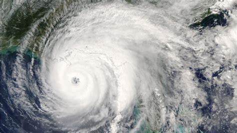
Judy Woodruff: Hurricane Delta is lashing the U.S. Gulf Coast tonight. The Category 2 storm is expected to make landfall in Southwest Louisiana this evening. Outer bands have been hitting throughout the afternoon, dumping rain in towns and cities including Galveston in Southeast Texas and pounding Lake Charles in Louisiana with strong winds. This is the second hurricane to hit the region in just six weeks. It is also the fifth hurricane and 10th named storm to make landfall in the U.S. this season, making this one of the most active hurricane seasons in a century. Ken Graham is the director of the National Hurricane Center. And he joins me now from Miami. Ken Graham, thank you for joining us again. Give us the very latest on where Hurricane Delta is.
Ken Graham: Yes, the very latest formation we have, still 105-mile-an-hour winds, so still a significantly strong hurricane here. And we are right now getting part of the eye wall moving on shore in Southwest Louisiana, very close to where we had Hurricane Laura also make landfall. So, as that moves forward, you're going to see more of those hurricane-force winds move into Louisiana. And it's a big storm. So, so many people, Judy are going to feel the tropical-storm-force winds, in addition to that hurricane-force wind.
Judy Woodruff: So, tell us what you are most concerned, what people should be most concerned about here. Is it the water, is it the winds, or both?
Ken Graham: Well, it really is both, because, if you look at the situation, it's a large storm. Larger storms produce more storm surge. The tropical-storm-force winds extend out about 160 miles from the center. And, as a result, that onshore flow is really causing the water to rise. And looking at some of these locations, we already have six-foot rises with the storm surge. This is not even high tide yet. So, the storm surge, historically, is the leading cause of fatalities in these tropical systems. And some areas here along the Louisiana coast, Vermilion Bay, could get seven to 11 foot of storm surge. That's inundation. That's literally water above land that's normally dry.

Judy Woodruff: What about the speed at which this hurricane is moving? What does that tell you?
Ken Graham: It really is moving fast. It's been really a fast-moving storm for most of its life cycle. And, as a result, it's moving quickly. So, you will see some of those hurricane-force winds further inland because of that speed. But, as a result, when it moves that fast, it'll actually, you won't get as much rain. So, you're still going to get big rainfall totals, some areas getting six to 10 inches of rain, but, because it's moving fast, you will start seeing some of those tropical-storm-force winds impact much of Louisiana, Alexandria, up to Monroe, and eventually some of those winds even getting into Northern Mississippi.
Judy Woodruff: As we just said, Ken Graham, one of the most active hurricane seasons in history. How are all of you at the Hurricane Center dealing with this? How do you see this?
Ken Graham: It has been busy. I mean, you think about breaking the record, as soon as we make landfall, breaking the record from 1916, with 10 landfalls in the U.S. We're working them. I mean, it's like, it's been all hands on deck. We're getting it done, and, really, just everything we could do to keep ourselves safe, to make sure we could keep everybody safe out there from these hurricanes.
Judy Woodruff: And there are always storms coming behind this one.
Ken Graham: Exactly. We still have a ways to go, Judy, in this hurricane season. So, it ends at the end of November. So, we got to keep our plans in place. We got to still watch the Tropics.
Judy Woodruff: Ken Graham at the National Hurricane Center, thank you so much.
Ken Graham: Thank you.


