CMUT stands for capacitive micromachined ultrasonic transducer. As its name suggests, it is a species of electrical capacitor, and, like all such, it is composed of two parallel plates. Any disturbance of these plates, such as the vibration induced by a sound wave, changes the capacitor's properties in a way that is easily detected.
CMUT是电容式微机械超声波换能器的缩写。顾名思义,它是一种电容器。此外,和其它电容器一样,它是由两块平行板组成的。平行板上的任何骚动,比如由声波引起的振动,都会改变电容器的属性,不过改变的方式很容易检测。
CMUTS were developed at Stanford two decades ago. They are widely used in ultrasonic medical scanners and are made in the same way as the micro-electromechanical deceleration sensors which trigger the deployment of car air bags, so they can be mass produced. PASS employs CMUTS tuned to resonate at the exact frequency of the sonic pulse generated by the laser. This has the double benefit of improving reception and filtering out background noise.
CMUTS是斯坦福大学20年前开发的,它们被广泛应用于超声波医疗扫描仪,与触发汽车气囊展开的微机电减速传感器的制造方式相同,因此可以大规模生产。PASS利用CMUTS进行调整,使其能够以激光产生的声波脉冲的精确频率共振,起到改善接收和过滤背景噪声的双重作用。

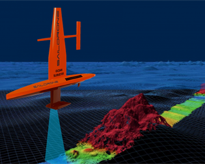
Preliminary tests in a university fish tank used a laser weighing 50kg, but this was a general-purpose device and the apparatus could, the team reckon, be scaled down to weigh just a few kilograms. That would fit on commercial camera-carrying drones. A device this size would be able to "see" through tens of metres of water, making it suitable for use above rivers, lakes and coastal waters. A larger version for deep-sea operations would fit on a manned helicopter or a larger drone and would be able to peer down to depths of hundreds, and eventually thousands, of metres. The team's researchers imagine fleets of such drones making short work of the task of charting the abyss.
研究人员在一所大学的鱼缸里进行的初步试验中使用了一束重达50公斤的激光。但这是一种通用设备,研究小组认为可以将其重量缩减到几公斤,从而可适用于携带摄像机的商用无人机。这种尺寸的设备可以“透视”数十米深的水,适合在河流、湖泊和沿海水域的上空使用。大一些的可用于深海作业,安装在有人驾驶的直升机或者更大的无人机上面,能够向下窥视数百米、最终将达到数千米的深度。该团队的研究人员设想,这样的无人机舰队将能够轻而易举地完成绘制深渊地形图的任务。
Deep thoughts
深思
Besides the scientific value of mapping the seabed with the sort of resolution normal for terrestrial cartography, PASS will also be able to locate the wrecks of missing ships and aircraft, and engage in commercial tasks such as monitoring underwater infrastructure like oil and gas pipelines.
除了具备用陆地制图学的分辨率法来绘制海床的科学价值,PASS还将能够定位失踪船只和飞机的残骸并从事商业任务,比如监测水下基础设施,如石油和天然气管道。
There are military applications, too, particularly for the detection of submarines. In this context it is no surprise that the project is being sponsored by America's Office of Naval Research. But for inhabitants of the third rock from the sun—or, at least, for those of them interested in hidden aspects of the orb they inhabit—the generation of the first high-resolution map of all of that orb's solid surface will be a matter of moment in its own right.
此外它还具备军事用途,特别是探测潜艇。就其强大的功能来说,这个项目能够得到美国海军研究办公室的资助便不足为奇了。但是对于居住在太阳外第三块岩石上的居民来说,或者至少对于那些对自己所居住的地球的隐秘方面感兴趣的人来说,绘制出第一张完整的地球固体表面的高分辨率地图将是一个重要时刻。
译文由可可原创,仅供学习交流使用,未经许可请勿转载。


